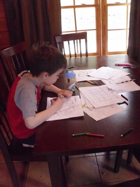
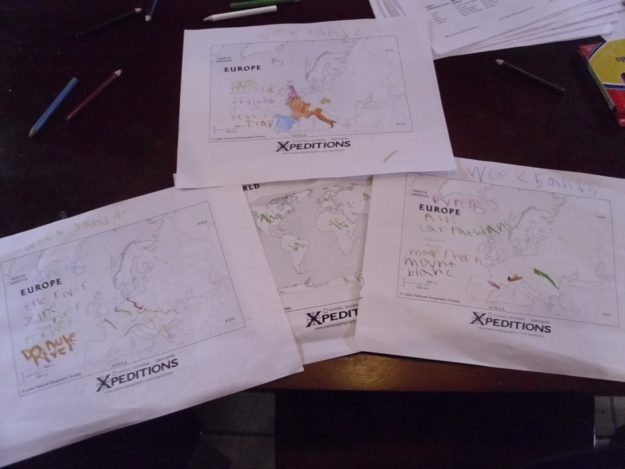
Though we haven’t gone into much detail regarding the World Wars, we are learning about the countries and world leaders during World War I and World War II, so I thought we’d touch on geography a bit here. When given the opportunity, Stephen likes to choose what to study (who doesn’t?!?), and, since he LOVES geography and has nearly finished memorizing all the countries in Europe and Asia, he decided to color-code and label blank geography maps we downloaded from National Geographic’s Mapmaker Interactive site. This is a really great site where you can download pdfs of each continent with or without country borders and with or without details (e.g., country names).


Stephen is also trying to memorize how to draw the world from memory, so he also does a lot of tracing at this point as well. Next year we will probably start using grids to draw the maps, unless he asks to do it before the end of this year. Can I mention now that he is WAY ahead of me here? For example, at this site (called Keith’s Think Zone Map Fun), there’s a world map and a U.S. map, but something’s awry. Well, I figured it out within a few minutes for the U.S. map, but I hate to admit that as I was still thinking that maybe Antarctica was missing on the World Map, Stephen walked up and in a split-second spoiled it for me. He saw the error immediately, and it wasn’t Antarctica. Now the error is so evident to me that it’s embarrassing.
Now, studying the world wars in elementary school is a bit advanced, but right now we are simply memorizing some information to use at a later date. But what’s surprising to me are the questions Stephen has asked just from the little bit we’ve learned. Before we started studying the world wars, I was able to convince the boys to watch The Sound of Music with me. Well, we later learned that Austria-Hungary were fighting alongside Germany as part of the Central Powers in WWI. Remembering what he saw in The Sound of Music, Stephen asked why Austria would have been invaded by Germany during WWII if they had been with Germany during WWI. I thought it was a great question from a 7-year-old! And it means he’s paying attention!
Because I was having trouble answering some of Stephen’s questions, I finally broke down and ordered The Story of the World Vol. 4, and it is AMAZING!!! It answers all those questions in such an understandable format. I mean, I finally understand history. WOOOHOOO!!! Stephen was so excited listening to the audio CD that he came down and told me how Albert Einstein moved to the United States because of Hitler. Stephen has already put in his request to go back to the Smith County Heritage Museum to look at the World War I and II exhibits again after Daddy gets home.
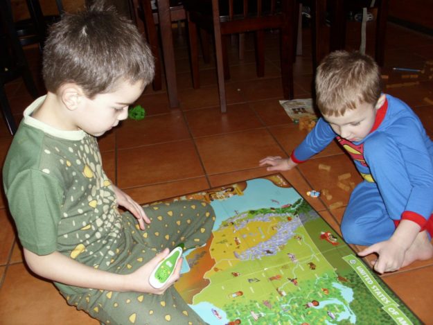
In case you’re wondering where the other two boys fit in with all of this, David just likes to sing history songs and color his laminated map with markers. And Levi just likes to color on HIMSELF with the markers, but… we’re working on it. For the most part, they just like to watch Stephen play Seterra geography games or those at spellingcity.com, but David is starting to try some things out now as well. They have a Leapfrog Tag Reader with U.S. Map, so we have fun playing with that fairly often, too.

I try to find coloring sheets about what we’re learning for David and Levi, and David usually has some copywork associated with it. A fascinating story that captured David’s attention, the story of Cher Ami, the pigeon that saved 200 lives during WWI.
I also remembered that we visited the American Museum of Science and Energy at Oak Ridge (The Secret City) last year. I searched our pictures, and I didn’t get a picture of the atomic bomb or WWII exhibits!!! Stephen and David don’t remember seeing any of it, though, so I imagine we will go again when we head to Knoxville in April.
